UN road map 1
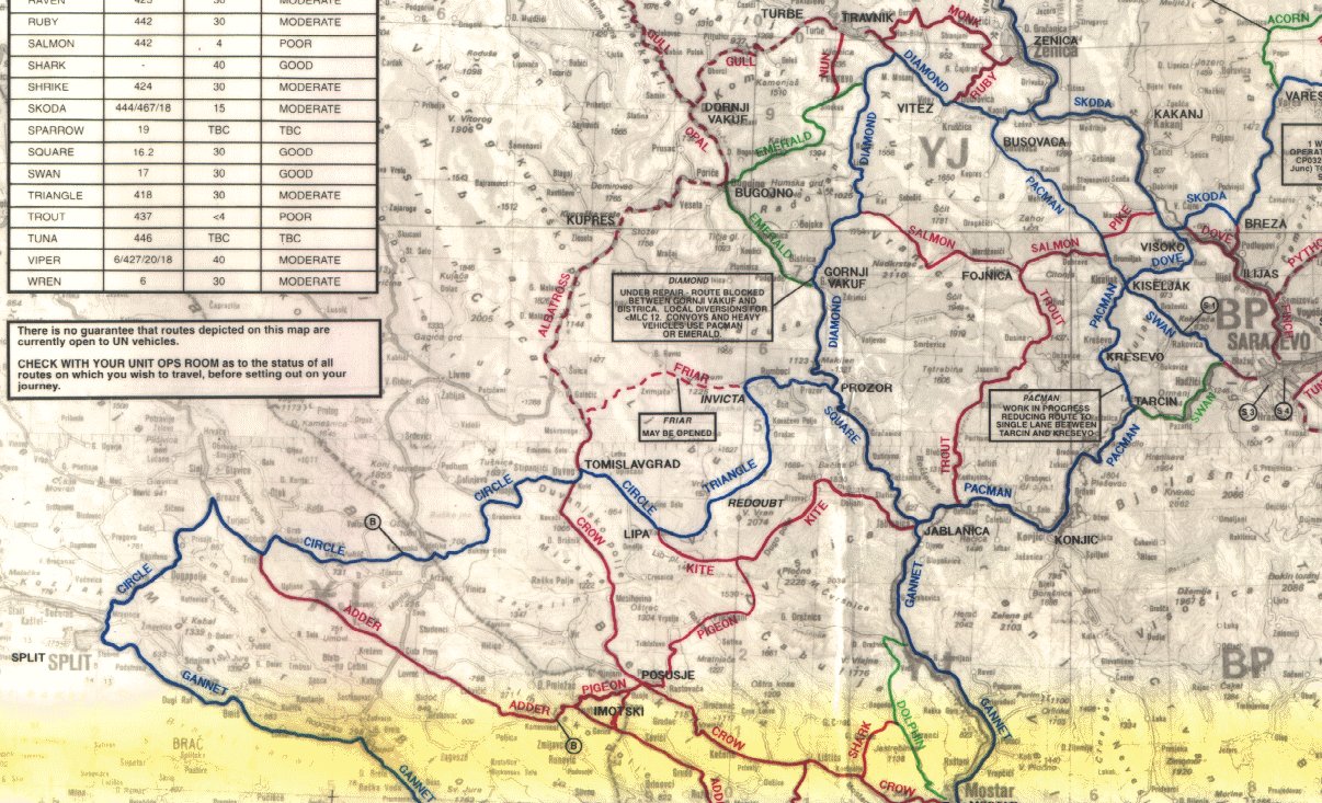
This was the official UN road / route map we had in our ambulance. I've scanned 3 images with the scanner in the office in Busovaca at that time. I don't have the means to ortho-rectify and mosaic them (Henk Kersten did it in 1995 and added 3D data to it to get some real nice overviews (using Leica Erdas Imagine software by the way, see Imagem BV)).
Update (2007-08-10) : we (Henk and I) finally did it: see here for a mosaic. It worked out really well, enjoy !
The basis of the map (in grey tones) is probably an English Royal Survey (?) map. The colored routes with their code names are very familiar to those who drove in convoys in Bosnia.
Image Taxonomy:
- Log in to post comments
- 14884 reads